• Home
  • About
  • Listed Climbs
Menu

Jeff Hebert

  • Home
  • About
  • Listed Climbs

The Triad

September 25, 2022

The Triad had come up a few times in conversations with climbing partners over the years. Goran had suggested we climb it on our way to the West Ridge of Eldorado. Colin and I had thought about ski touring over to it from Hidden Lake Lookout. But it hadn’t quite made it to the top of the list yet. During this odd time when my rock climbing shape is at an all-time low, it seemed like a nice single-day, late-summer objective.

Mitch and I drove to the Hidden Lake Trailhead on Saturday night and found a nice flat spot to sleep for the night. We’d packed and remembered everything except for his sleeping bag, and so he spent a pretty sleepless handful of hours while I happily floated off to sleep. We got moving right around 5:15am on Sunday morning, making quick time and reaching our turnoff from the main trail in 1 hour. Less than 15 minutes later, we were at the saddle to start the ridge as the sunrise alpenglow started lighting up the North Cascades.


The heather-covered ridge was truly awesome, with views of Baker, Shuksan, and The Pickets to the Northwest and the North Cascades laid out all around us otherwise, with Eldorado, Forbidden, Boston, Sahale, and Johannesburg close by and a close-up view of Hidden Lake. We hiked along the ridge for about 30 minutes before finding the spot to descend to the glacier on the North side of the ridge. It was quite firm in the early morning and we were glad we’d brought aluminum crampons and light axes.

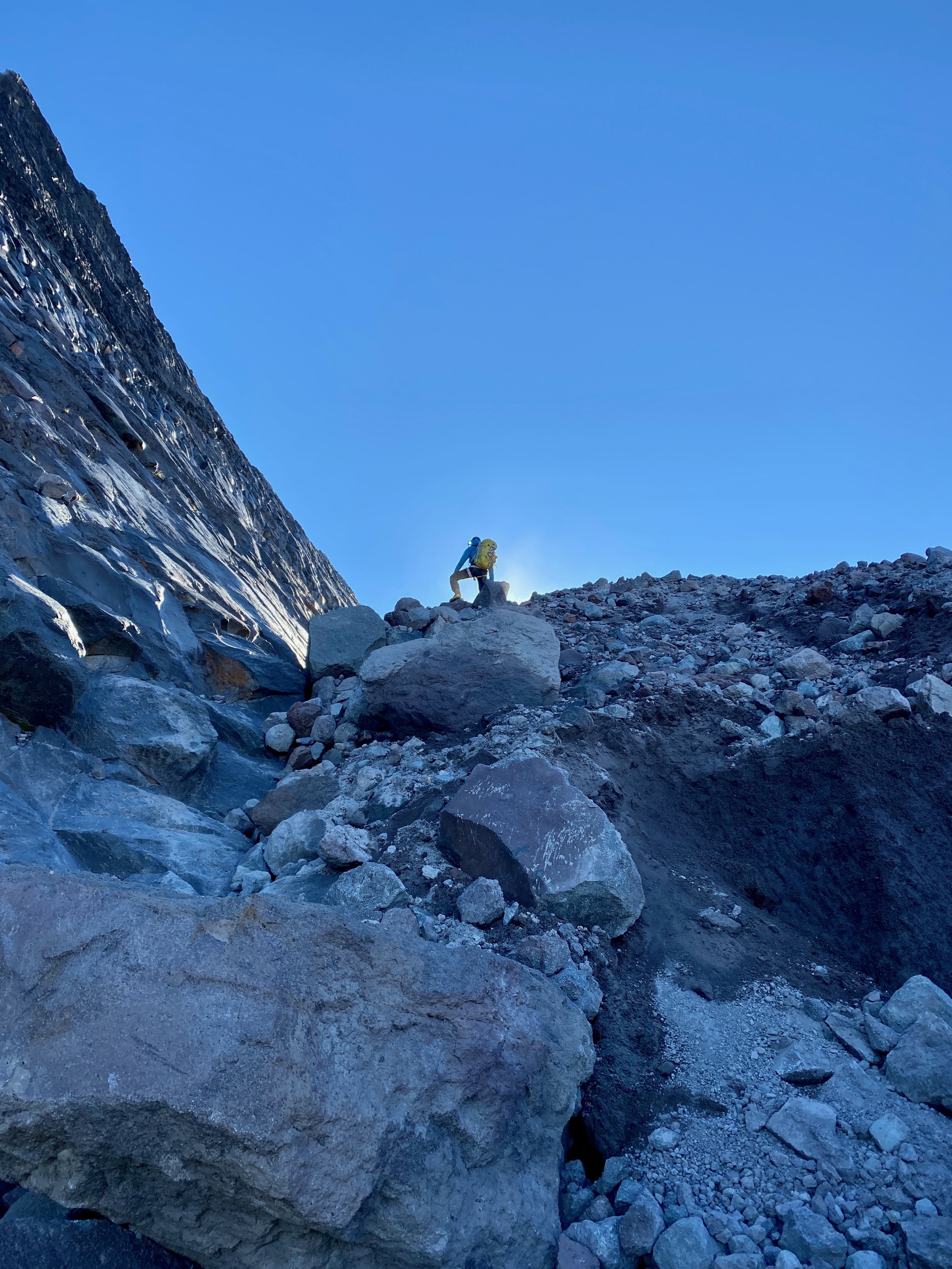
The 3rd class descent toward the South from the next saddle at the end of the glacier section was pretty terrible. Loose rock and dirt on top of very steep rock and heather made for a stressful hundred feet or so before it turned into just plain unpleasant scree. We were glad to get past this “Drainage of Despair” as Mitch dubbed it and into the next drainage to the East, which was much better-behaved. We found our way down and across this drainage, then headed straight for the high saddle which started the East Ridge. It was about 9:45am at this point, so roughly 4.5 hours from the car. Things had slowed down considerably since the trail had ended on the ridge.

We had a snack and put our harnesses on before heading along the ridge. It was relatively straightforward to gain the ridge via some ramps and then a slabby section that switched back near the crest where we saw an old rap anchor. The very next section was the low-5th class pinnacle, which we decided to rope up for. I plugged in a little bit of gear, but the protection wasn’t great. Thankfully, while the climbing was exposed and relatively steep, it was quite easy with good holds throughout. I belayed Mitch through this section and then we scrambled together to the true summit at 11:15am, 6 hours after leaving the car. Our up-close-and-personal view of Eldorado was pretty awesome.

There’s not much to report about our descent. We rappelled the 5th class step and scrambled through everything else. The heather-covered ridge was now showing off all of its colors. And we saw a bear sauntering along the trail ahead of us. Whiskey helped me float down from the main trail junction pretty expeditiously for a car-to-car of about 10.5 hours. While the climb itself was short lived and the Drainage of Despair was pretty terrible, it was a gorgeous place and a nice, low-5th climb in the heart of the North Cascades.

In Climbing
Comment

Mount Fernow

September 5, 2022

Mount Fernow had been on my list to climb since my first trip to the Entiat, mainly, as George Mallory famously said, “because it’s there.” It’s the eighth-highest peak in Washington State at 9,249 feet. My research of the route itself suggested there was a reasonably high price of admission in the form of cross-country travel from Leroy Basin, loose scree, and a route that looked to be mainly 3rd class with a small bit of 4th at the top. Recovering from getting COVID two weeks prior, I wasn’t sure if this climb would set me back or make me feel better. It was a bit of a roll of the dice.

Mitch and I drove out on the Sunday evening of Labor Day weekend seeing that the best day for it was on the holiday itself. We crashed at 11pm in a tent at the surprisingly quiet parking lot at 3,500 feet with alarms set for 4am and got moving in the morning just after 4:30am.

Having been back in the area for the North Face of Maude earlier this summer, the approach to Leroy Basin felt all too familiar, but it helped to bang much of it out in the dark. It took us exactly 2 hours to reach the camping area in Leroy Basin. From there, we made it to the 7,800-foot col on the shoulder of Seven Fingered Jack in another hour or so.

The view from this col was a bit disheartening. The descent looked really loose and it didn’t look like things would improve much all the way to the summit. We made our way down and it wasn’t quite as bad as it looked most of the way, but it was certainly unsavory. At 8:30am, we had finished losing vertical down to 6,600 feet or so.

The route itself was a lot less steep than it looked from the col and wasn’t as loose as the approach until the top where it was equally shitty. We reached the summit at 10:25am, just shy of 6 hours after we’d started. The views were thankfully stellar, with Glacier Peak feeling like we could reach out and touch it. We had lunch and then retraced our steps. It was painful. A huge amount of loose rock made for quite the ankle workout, including plenty of near misses, slips, and falls. By the time we made it back to the col, we were very much over the loose rock.

We made it back to the car before 5pm for about a 12-hour day, which felt reasonably quick for the amount of cross-country travel we’d done on loose terrain as well as the nearly 8,000 feet of up and down. Thankfully, I felt a better over the course of the day. I’m glad I’ve done it, but I have absolutely no desire to go back. Not recommended.

In Climbing
Comment

Frostbite Ridge on Glacier Peak

August 7, 2022

As the fourth-highest peak in Washington State and a beautiful, remote objective, I always wanted to climb more than just the standard route on Glacier Peak. With a perfect weather window over an early-August weekend and a good friend and climbing partner willing to suffer a bit, it was time.

Adam and I drove out to the North Fork Sauk Trailhead on Saturday morning with open bivy gear, one axe and one light axe each, crampons, a 30m glacier rope, a few ice screws, a couple of pickets, trail runners, boots, and, perhaps most importantly, a good supply of whiskey. Our 3-day, lollipop plan was to hike 20 miles the first day to get near the start of the Kennedy Glacier, then climb the route and descend the Cool Glacier on the other side a good ways before camping again and then hiking out on the morning of the third day.

We left the car at 10am and hiked up the standard approach until we hit the PCT, where we took a left up to Red Pass. We ran into a number of through-hikers on the PCT and each of them was a bit surprised to hear we were there to climb Glacier Peak. We also ran into a soloist who said he’d started up the Kennedy Glacier, but turned around. It was a bit ominous hearing that as we marched our way North on the PCT.

The variety and amount of ground we covered this first day was pretty cool and we enjoyed it as much as we could despite the slowly-building pain creeping into our feet, shoulders, and hips. It was after 7pm when we made it to the tricky crossing of the Kennedy Creek. We just put our heads down from here and hiked up Kennedy Ridge to 5,300 feet where we expected to leave the PCT in the morning and saw a creek on the map, hoping there would be somewhere flat to bivy. We arrived at 8pm to find a nice little campsite with one other person, quickly set up shop, and conked out.

The mileage and vertical gain from camp to the summit didn’t seem to warrant an alpine start, so we woke up at 5am and were moving by 6am. Heading straight up from camp was exactly the right move and quickly put us on a large moraine overlooking the entire North side of Glacier. There were some old signs of traffic, but the area had the feel of being forgotten and much more remote than other big peaks in Washington.

We switched from trail runners to boots at the toe of the Kennedy Glacier at 7:30am, keeping crampons on our backs to start since the snow was reasonably soft and there was a clear dirty, rocky band to get through on the glacier below Kennedy Peak. This section was perhaps the most dangerous of the route—it was a crumbling mess with big boulders waiting to succumb to potential energy, perched on glacial till. After gingerly getting through this bit, we were on the wide-open Kennedy Glacier with very little crevasse hazard on its left half.

Things were uneventful until we got to Frostbite Ridge itself. We could see the Rabbit Ears feature above us and our options were getting on a pumice treadmill up the ridge or staying on steep snow to the left. We opted to keep crampons on and stick to the snow. We stayed left past the first gendarme and on some of the steepest snow (~50 degrees) near the top, which went pretty easily with our second axes. The snow took us almost to the top of the face and then we scrambled a few feet to the highest point, just to the right of the highest gendarme (the Rabbit Ears themselves, it turned out) at 12:30pm.

From here, we could see the rest of our route and it looked like it would all go. We could also see our 3rd class descent to the upper Kennedy Glacier. It looked loose and nasty, but ended up being quite reasonable and quick. The first 50 feet up the snow on the other side were steep, but it eased off significantly from there and we romped our way up, across, then down to the saddle below the final face.

The face had the glimmer of ice to it, which was a welcome departure from walking. We determined the angle was low enough and the steep part short enough that it made more sense to solo than to pitch out. I set off and enjoyed settling into the flow of ice climbing despite the knuckle-bashing involved with straight-shaft axes. After the ice step of 40 feet or so, it was back to snow until the top, but it steepened up again right near the summit and made sense to front-point with both axes—quite fun to climb that way right to the summit. We arrived at 2:15pm.

The descent was straightforward and pretty efficient on sloppy snow. We never needed the rope and took our crampons off as soon as we were down the initial steeper sections. We descended all the way to the plateau at 6,750 feet where we found a nice spot to camp off snow with great views.

We got moving the next morning at 7:15am and were back to the car a little after noon. We stopped at the bottom of the switchbacks before the final flat slog out to consume most of the remaining whiskey and floated on a cloud of air most of the way back to the car.

This route had a more adventurous, remote, wild feel than lots of other climbing in Washington. In a way, it felt more like a destination climb I would have flown somewhere to do. Yes, the walking to climbing ratio was quite high and we never took the rope out, but it did bring some fun challenges, stellar views, and time way out there.

6 Comments
Older Posts →

Recent Trip Reports

Featured
IMG_9162.jpg
May 31, 2025
Mallory-Porter on Aiguille du Midi
May 31, 2025
May 31, 2025
ventoux.jpg
May 18, 2025
Mont Ventoux
May 18, 2025
May 18, 2025
IMG_6830.jpeg
Sep 21, 2024
South Face on Aiguille du Moine
Sep 21, 2024
Sep 21, 2024
IMG_6771.jpeg
Sep 19, 2024
Barbaresco to Barolo
Sep 19, 2024
Sep 19, 2024
IMG_3321.jpeg
Sep 15, 2024
Cosmiques Arete on Aiguille du Midi
Sep 15, 2024
Sep 15, 2024
IMG_5955.jpeg
Jul 27, 2024
Rainier Vertfest
Jul 27, 2024
Jul 27, 2024
IMG_5609.jpeg
Jul 13, 2024
Mary Green Glacier on Bonanza Peak
Jul 13, 2024
Jul 13, 2024
IMG_4891.jpeg
Apr 13, 2024
Chair Peak Circumnav CCW
Apr 13, 2024
Apr 13, 2024
IMG_8600.jpeg
Dec 14, 2023
Mount Aspiring NW Ridge
Dec 14, 2023
Dec 14, 2023
IMG_2329.jpeg
Jul 16, 2023
West Ridge on Mount Thomson
Jul 16, 2023
Jul 16, 2023
IMG_1974.jpeg
May 28, 2023
South Ridge on Mount Jefferson
May 28, 2023
May 28, 2023
IMG_1736.jpeg
May 13, 2023
Little Tahoma via Paradise
May 13, 2023
May 13, 2023
IMG_3023.jpeg
Mar 18, 2023
Nisqually Chute on Mount Rainier
Mar 18, 2023
Mar 18, 2023
IMG_9312.jpeg
Feb 12, 2023
The Slot Couloir on Snoqualmie Mountain
Feb 12, 2023
Feb 12, 2023
IMG_0141.jpeg
Sep 25, 2022
The Triad
Sep 25, 2022
Sep 25, 2022
IMG_0024.jpeg
Sep 5, 2022
Mount Fernow
Sep 5, 2022
Sep 5, 2022
IMG_9826.jpeg
Aug 7, 2022
Frostbite Ridge on Glacier Peak
Aug 7, 2022
Aug 7, 2022
IMG_9661.jpeg
Jul 23, 2022
North Face of Mount Maude
Jul 23, 2022
Jul 23, 2022
IMG_9557.jpeg
Jul 9, 2022
Tahoma Glacier on Mount Rainier
Jul 9, 2022
Jul 9, 2022
IMG_9431.jpeg
Jun 25, 2022
Squak Glacier on Mount Baker
Jun 25, 2022
Jun 25, 2022
IMG_8289.jpeg
Mar 16, 2022
Bow-Yoho Traverse
Mar 16, 2022
Mar 16, 2022
IMG_7941.jpeg
Jan 29, 2022
Oyster Couloir on Wright Mountain
Jan 29, 2022
Jan 29, 2022
IMG_7717.jpeg
Oct 16, 2021
Mount Saint Helens Windy Ridge Ride
Oct 16, 2021
Oct 16, 2021
IMG_7676.jpeg
Oct 2, 2021
North Cascades Highway Ride - Newhalem to Mazama and Back
Oct 2, 2021
Oct 2, 2021
PXL_20210721_200419965.jpg
Jul 21, 2021
Twin Sisters Traverse
Jul 21, 2021
Jul 21, 2021
IMG_7050.jpg
Jul 18, 2021
Mount Challenger via Whatcom Pass
Jul 18, 2021
Jul 18, 2021
IMG_6821.jpg
Jun 26, 2021
Emmons Glacier on Rainier Car to Car
Jun 26, 2021
Jun 26, 2021
IMG_6572.jpg
May 30, 2021
Park Glacier on Mount Baker
May 30, 2021
May 30, 2021
IMG_6402.jpg
May 15, 2021
Mesachie Glacier
May 15, 2021
May 15, 2021
IMG_6185.jpg
May 2, 2021
Northwest Face on Cashmere Mountain
May 2, 2021
May 2, 2021

© 2020 Jeffrey J. Hebert